
Longitude: E 022° 57.546
 |
A child on a road trip with his family asks, "Where are we?" and the father answers, "Let's check the map. We're off the blue roads [the Interstate Highways marked in blue on the road atlas]. We're off the red roads [the US and state highways]. We're off the black roads [the county highways]. I think we're off the map altogether." It was always my dream to be off the map altogether.
After the jump, a few of the random places (and I mean random literally) that I visited vicariously last month that are "off the blue roads".
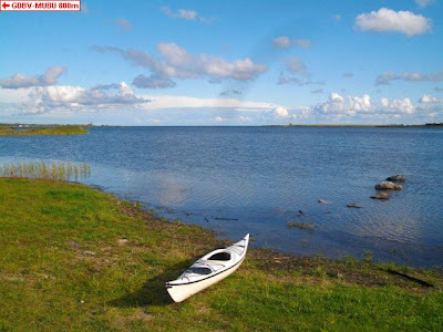
- in Kunnati Bay of the North Sea off the coast of Estonia's Saarema island
- in the Potomac River, less than 100 meters off the Virginia shore, but technically in Maryland, unreachable for lack of public land along the shore
- in a muddy farm field in Germany with a view of Marienburg castle
- in Omaha, Nebraska's Skutt Catholic High School, flying banners proudly proclaiming to be one of the top 50 high schools to receive the U.S. Dept of Education Blue Ribbon Award
- in New South Wales, 58 meters behind a fence at a former Australian Defence Industries munitions factory site, now home to emus and kangaroos ("I was greeted by an emu upon arrival!")
- in New Mexico, in flat land with lots of sticker bushes on the edge of the White Sands Missile Range, 24 km north of the Trinity atomic bomb testing site
- in the bush in New South Wales ("with spring here, a lot of native plants are flowering and it looked quite pretty")
- in a ponderosa pine forest mixed with sagebrush near Flaming Gorge reservoir in northeast Utah on the eastern edge of the Uintah Mountains
- in Tennessee, just off a very narrow road just past the Harrisburg Covered Bridge
- in Victoria, Australia, in a brick house with large yuccas in a fairly new suburb close to Cranbourne Golf Course
- off Clarksville Highway in Tennessee, near several old clapboard ranch houses with an out building with old signs nailed to it advertising Nehigh, RC Cola, Kay's Ice Cream and Sargent's Paint
- in the middle of a residential block in Friesdorf, Germany, in the garden behind a white garage, guarded by a high fence and a security camera
- in Eureka, Missouri, in a new subdivision with closely spaced, two-story houses with brick facades on the ground level and dormers on the upper story
- in a two story house in Hillsborough, California, with a front porch framed by slender columns ("if you dicker you can pick it up for a mere $1.7 million")
- outside Chicago, in a cornfield, now in full tasseled regalia, awaiting the late summer drying and ultimate harvest
- in flat, hot, dry farmland near Iowa State University
- in the small town of Onyx, California, near Bakersfield, on a dirt road leading to a landmark the maps call "Indian Cemetery"
- in Missouri, in woods across a dry creek bed in the rolling hills south of the Missouri River, surrounded by what the maps say should be cemetery, but without markers of any kind
- and in scrubby brush of Victoria, Australia's Rushworth State Forest, with screeching white cockatoos and pink and grey galahs in abundance
No comments:
Post a Comment