
Longitude: 121.4190 W
 |
A child on a road trip with his family asks, "Where are we?" and the father answers, "Let's check the map. We're off the blue roads [the Interstate Highways marked in blue on the road atlas]. We're off the red roads [the US and state highways]. We're off the black roads [the county highways]. I think we're off the map altogether." It was always my dream to be off the map altogether.
After the jump, a few of the random places (and I mean random literally) that I visited vicariously last month that are "off the blue roads".
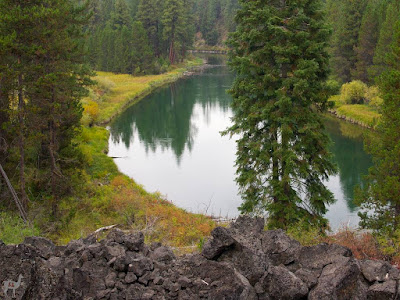
- in a gentle stretch of the Deschutes River in Oregon, scorable from the Deschutes River Trail
- in a nice sunny forest, by a fallen tree, in Estonia near an abandoned Soviet military airfield
- on the desolate Atlantic Ocean beach in southern Brazil, with occasional groups of fishermen's huts and ropes stretched out across the beach
- in an intersection at the southeast corner of Fermilab National Accelerator in Illinois (nearby street names are Enrico Fermi Ct, Albert Einstein Lane, Pierre Currie Ct, etc.)
- in Italy, on a road being resurfaced on the grounds of a large hospital called Cisanello
- out of reach inside the gates of the National Naval Medical Center in Maryland
- near a roundabout in the Netherlands, near a construction area fence painted with colored stick figures
- on a bike and walking trail along the Canyon Del Oro Wash in Arizona
- in a field outside of the city of Barnsley in West Yorkshire ("It looks like someone may have been sleeping rough nearby as there were some old jackets abandoned on the side of the path and some evidence of someone having made up a small shelter.")
- near a small soccer goal adjacent to an large log house outside Melbourne
- near a weatherboard house with a nice view of the foreshore park on Westernport Bay, southeast of Melbourne
- in a backyard in Kurrajong Heights, outside of Sydney, near a view where nearly all of Sydney basin can be seen
- in a paddock about 30 km north of Adelaide, South Australia
- in a soybean field in Illinois, 140 meters from a lonely county road
- in the wide median of Highway 2 in Minnesota ("The soybean harvest is in full swing here in northwestern Minnesota, with giant combines, trailing dust clouds, charging through the fields, gobbling the plants and depositing the beans in trucks and wagons.")
- in the Langsdale Library on the "campus" of the University of Baltimore ("there is no clear indication of the campus other than most of the buildings in the area are associated with the U of Baltimore.")
- in Italy, on the banks of a small river levee planted with olive trees and topped by an old stone wall
- surrounded by trumpet chanterelles (Chantarellus tubaeformis) and hedgehog fungi (Hydnum repandum) in the forest of Kemiö, the second largest island in Finland's sea area
- in a plowed field in Minnesota near a large wind turbine farm to the southeast
- on a track between vegetable patches outside Naples, with Mount Vesuvius and the ruins of a fortress in full view
- in Finland, at the foot of a hill that is home to some Bronze Age graves
- near the Woodlands Historic Park in Victoria, Australia, home to a mob of 20 large grey kangaroos and a group of recent aboriginal graves
- at the edge of an unharvested cornfield in Iowa, near a strangely wrecked grain silo, possibly a tornado casualty
- on the far side of a small marsh in Finland ("I could not walk exactly to zero point, the last 30 meters were too difficult, too wet. Today it was raining snow and water and the temperature was 0 Celsius. First signs of the coming winter.")
- and in Ohio, by a beige brick duplex all decked out for Halloween with outside decorations in the front yard
No comments:
Post a Comment